Povey Drones Captures Images & Data For
Airports | Cities | Communications Towers | Search & Rescue | Farms & Ranches | Mines | Bridges | Accidents | Construction Sites
Povey Drones Captures Images & Data For
Airports
Cities
Communications Towers
Search & Rescue
Farms & Ranches
Mines
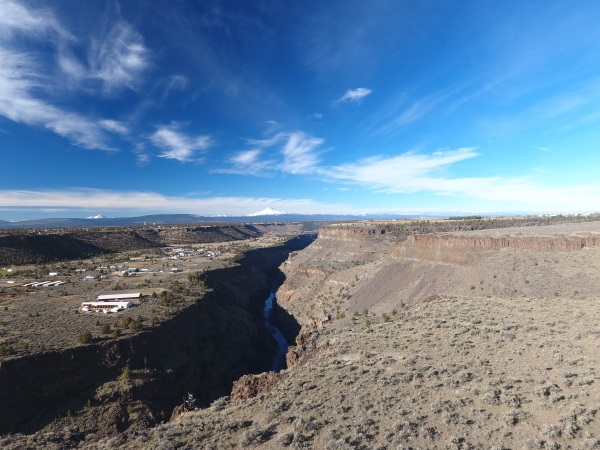
Bridges
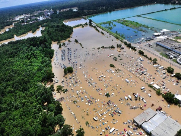
Accidents
Construction Sites


Drone technology can provide golf course owners and managers with a wide variety of information including:
Soil composition & hole analysis
Maintain course health
Visually document areas for renovation and capital improvement
Create 3D models to create a virtual tour experience
Market the course and its facilities
Drone mapping also helps players plan their game and their trip before they reach the course

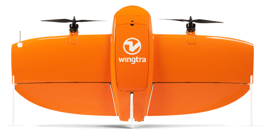
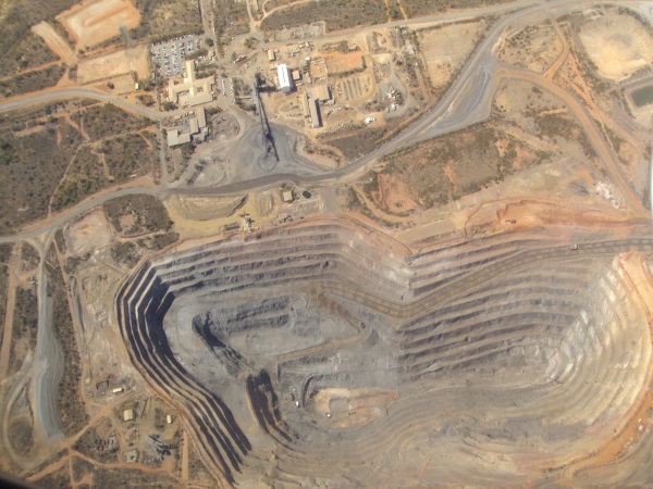
The WingtraOne provides data based on quantities of the material removed, eroded or changed over the course of time. This includes:
Stockpile Tracking
Material Removal Tracking
Accurate terrain models
Measure excavation in volume, width, and distance
Manage aggregates, equipment, roads, and structures with easily identifiable imagery.
We produce large and accurate data sets in just a few hours without need for externally sourced imagery.
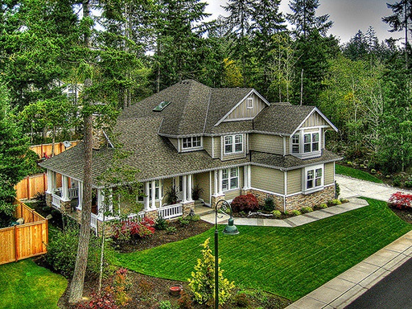
Povey & Associates Drone Services
Streamline claims adjustment and underwriting
Assist adjusters with aerial inspection
Collect necessary data and imagery
Commercial and residential roofs inspections
Povey & Associates Drone Services to accurately assess the damage and begin claim reporting.
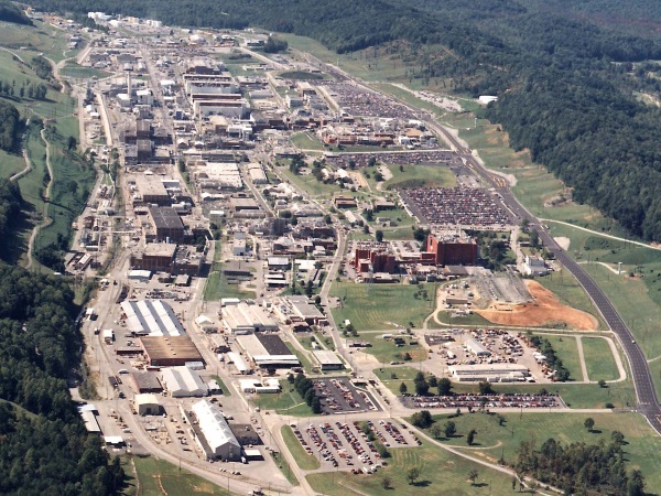
Using our fleet of drones, municipalities can view their cities, outlying areas and overall topography in a new way.
Assess Roads
Assist Code & Law Enforcement
Fire & Search & Rescue
Investigation and Training
We provide highly precise data, rapid deployment, emergency response capability and operational effeciency to cities, towns, rural areas, counties and municipalities in Deschutes, Jefferson and Crook County.
A seasoned surveyor and licensed pilot can acquire geo-referenced digital aerial images with sharp, clear resolutions. In addition, our drones can:
Provide precise measurements
Keep crews and teams safe
Create effeciencies
Generate an orthomosaic image
When conditions are not conducive to having a team on the ground, Povey Drones can capture the images and measurements you need.

Povey & Associates Drone Services provides the best way to:
Track job progress
Conduct job site surveys
Create a visual history of a project
Roofing and HVAC contractors can add another element to pre-bid packages using visual inspections done with drone flights.
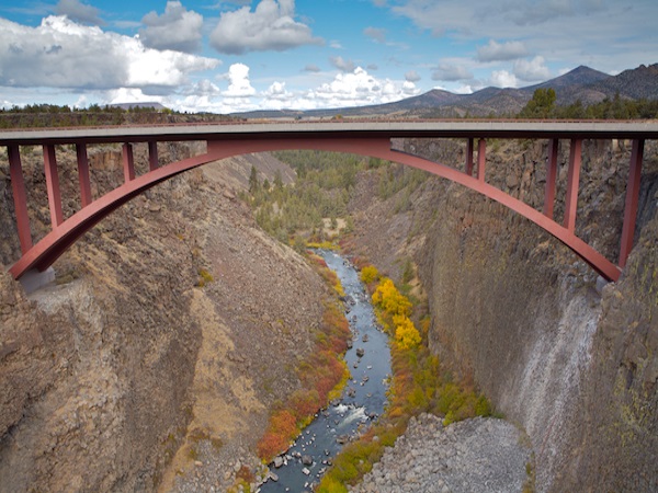
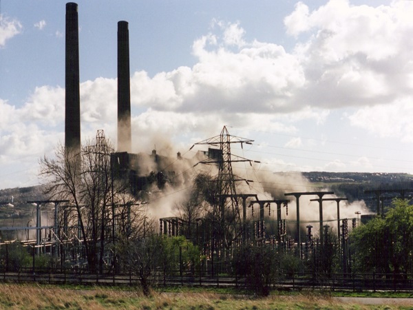
Povey & Associates Drone Services provides a safer, faster, more convenient, and less expensive way to inspect power lines, cell phone towers, windmills, dams, railroads, transmission towers, smoke stacks, and bridges.
Easily spot signs of fraying or corrosion
Monitor expansion joints, bolts, seals and stress points
Inspect vertical walls in mines, pits, roads, tunnels
Conduct preventative inspections of flare stacks, pipelines, spills & damage, along with viewing and managing critical equipment efficiently and effectively providing detailed imagery.
Povey & Associates Drone Services can fly into dangerous situations to perform risk assessment and guide first responders to track the real time effects
Instant visual feedback
Protect Police, Fire, Search & Rescue
Functionality in tight, dense or dangerous areas
View photos or video of incident or situation in real time
Povey & Associates Drone Services assists in emergency situations that may include missing persons, crowd control, fire support, natural disasters, and ground pursuits. We help you see what’s happening before deploying.
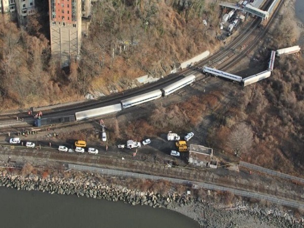
Accident investigations, damage assessments, liability determination, cause of action and point of origin can be made easier to ascertain from another perspective. Consider adding a drone to your investigation team for:
Instant visual feedback
Functionality in tight, dense or dangerous areas
Viewable photos or video of incident or event in real time
When you need another perspective on accident investigation, Povey & Associates Drone Services is here to help.
Povey & Associates Drone Services creates virtual exterior tours of lots, land, ranches, farms and estates.
Improve the sale-ability of residential and commercial real estate and reduce the days-on-market time with a 360 degree, birdseye view.
Drone technology can provide golf course owners and managers with a wide variety of information including:
Soil composition & hole analysis
Maintain course health
Visually document areas for renovation and capital improvement
Create 3D models to create a virtual tour experience
Market the course and its facilities
Drone mapping also helps players plan their game and their trip before they reach the course
The UX5 provides data based on quantities of the material removed, eroded or changed over the course of time. This includes:
Stockpile Tracking
Material Removal Tracking
Accurate terrain models
Measure excavation in volume, width, and distance
Manage aggregates, equipment, roads, and structures with easily identifiable imagery.
We produce large and accurate data sets in just a few hours without need for externally sourced imagery.
Using fixed wing drones, municipalities can view their cities, outlying areas and overall topography in a new way.
Assess Roads
Assist Code & Law Enforcement
Fire & Search & Rescue
Investigation and Training
We provide highly precise data, rapid deployment, emergency response capability and operational effeciency to cities, towns, rural areas, counties and municipalities in Deschutes, Jefferson and Crook County.
A seasoned surveyor and licensed pilot can acquire geo-referenced digital aerial images with sharp, clear resolutions. In addition, our drones can:
Provide precise measurements
Maximize ROI
Create effeciencies
When conditions are not conducive to having a team on the ground, Povey Drones can capture the images and measurements you need.
Povey & Associates Drone Services provides the best way to:
Track job progress
Conduct job site surveys
Create a visual history of a project
Roofing and HVAC contractors can add another element to pre-bid packages using visual inspections done with drone flights.
Povey & Associates Drone Services provides a safer, faster, more convenient, and less expensive way to inspect power lines, cell phone towers, windmills, dams, railroads, transmission towers, smoke stacks, and bridges.
Easily spot signs of fraying or corrosion
Monitor expansion joints, bolts and seals
Inspect vertical walls in mines, pits, roads, tunnels
Conduct preventative inspections of flare stacks, pipelines, spills & damage, along with viewing and managing critical equipment efficiently and effectively providing detailed imagery.
Povey & Associates Drone Services can fly into dangerous situations to perform risk assessment and guide first responders to track the real time effects
Instant visual feedback
Protect Police, Fire, Search & Rescue
Functionality in tight, dense or dangerous areas
View photos or video of incident or situation in real time
Povey & Associates Drone Services assists in emergency situations that may include missing persons, crowd control, fire support, natural disasters, and ground pursuits. We help you see what’s happening before deploying.
Accident investigations, damage assessments, liability determination, cause of action and point of origin can be made easier to ascertain from another perspective. Consider adding a drone to your investigation team for:
Instant visual feedback
Functionality in tight, dense or dangerous areas
Viewable photos or video of incident or event in real time
When you need another perspective on accident investigation, Povey & Associates Drone Services is here to help.
Povey & Associates Drone Services creates virtual exterior tours of lots, land, ranches, farms and estates.
Improve the sale-ability of residential and commercial real estate and reduce the days-on-market time with a 360 degree, birdseye view.
Povey & Associates Drone Services
Streamline claims adjustment and underwriting
Assist adjusters with aerial inspection
Collect necessary data and imagery
Commercial and residential roofs inspections
Povey & Associates Drone Services to accurately assess the damage and begin claim reporting.
POVEY & ASSOCIATES DRONE SERVICES
PAUL POVEY
FAA LICENSED | BONDED | INSURED
(541) 480-2690
USA DOT FAA #3920299
OFFICE ADDRESS
338 SW 7TH STREET REDMOND OR 97756
MAILING ADDRESS
PO BOX 131 REDMOND OR 97756
Drone services are just a call or email away.
POVEY & ASSOCIATES
DRONE SERVICES
PAUL POVEY
FAA LICENSED
BONDED
INSURED
USA DOT FAA #3920299
OFFICE ADDRESS
338 SW 7TH STREET REDMOND OR 97756
MAILING ADDRESS
PO BOX 131 REDMOND OR 97756
Drone services are just a call or email away.