Povey Drones Takes Your Projects To New Heights
Providing drone services throughout Oregon to
Industries | Businesses | Municipalities | Search & Rescue | Farmers | Ranchers | Golf Courses | Solar Farms | Growers
Povey Drones Takes Your Project To New Heights
Our firm provides drone services throughout Oregon to
Industries | Businesses | Cities
Search & Rescue Teams
Farmers & Ranchers
Golf Courses
Solar Farms
Growers


HARNESS THE POWER OF FLIGHT
Povey Drone Services provides highly precise data, rapid deployment, emergency response capability and operational effeciencies to cities, towns, rural areas, counties and municipalities in Deschutes, Jefferson and Crook County.
HARNESS THE POWER OF FLIGHT
Povey Drone Services provides highly precise data, rapid deployment, emergency response capability and operational effeciencies to cities, towns, rural areas, counties and municipalities in Deschutes, Jefferson and Crook County.
FAA LICENSED UAS PILOT
Our drones are flown by a FAA Certified & Licensed UAS Pilot with years of surveying experience, hours of live flights and an investment in continuing education.
Povey & Associates Drone Services is licensed and certified under FAA Part 107 as well as being insured to provide drone services.
USA DOT FAA #3920299
POVEY DRONES TAKE FLIGHT
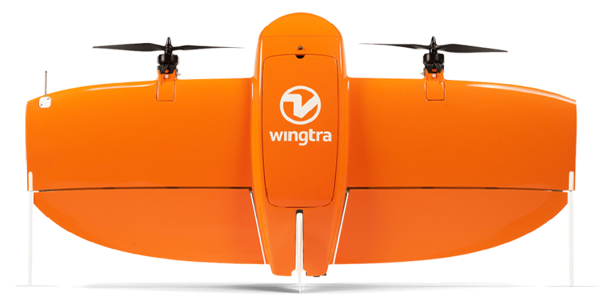
MEET THE WINGTRAONE
SEE YOUR WORLD LIKE NEVER BEFORE
By combining a robust and highly user-friendly system with a custom designed camera, we take surveying to new heights.
Povey Drone Services combines generations of surveying experience with the power of flight to improve efficiency, increase accuracy and reduce redundancies across industries and sectors. We can produce large and accurate data sets in just a few hours.
![]()
POVEY DRONES TAKE FLIGHT
FAA LICENSED
UAS PILOT
Our drones are flown by a FAA Certified & Licensed UAS Pilot with years of surveying experience, hours of live flights and an investment in continuing education.
Povey Drone Services is licensed and certified under FAA Part 107 as well as being insured to provide drone services.
USA DOT FAA #3920299
GET TO KNOW THE WINGTRAONE
SEE YOUR WORLD LIKE NEVER BEFORE
By combining a robust and highly user-friendly system with a custom designed camera, we take surveying to new heights.
Povey Drone Services combines generations of surveying experience with the power of flight to improve efficiency, increase accuracy and reduce redundancies across industries and sectors. We can produce large and accurate data sets in just a few hours.
![]()
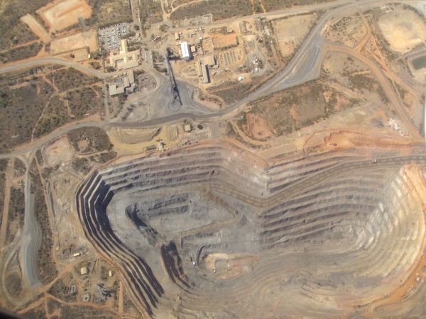
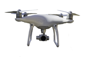
MINING MEASUREMENTS
The WingtraOne and Phantom 4 Pro in our fleet provide data based on quantities of the material removed, eroded or changed over the course of time.
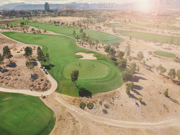
GOLF COURSES
Provide a drone’s eye view to map golf course management and market the course to new members and event coordinators.
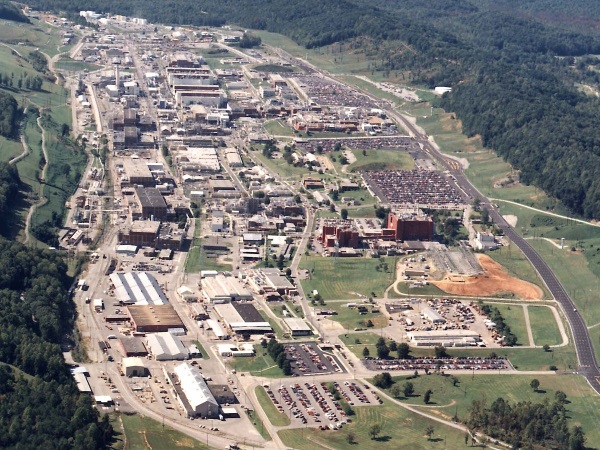
CITIES & TOWNS
Using fixed wing drones, municipalities can view their cities, outlying areas and overall topography.
ACRES COVERED
MINING MEASUREMENTS
The WingtraOne provides data based on quantities of the material removed, eroded or changed over the course of time.
GOLF COURSES
Provide a drone’s eye view to map golf course management and market the course to new members and event coordinators.
CITIES & TOWNS
Using fixed wing drones, municipalities can view their cities, outlying areas and overall topography.
FLIGHTS
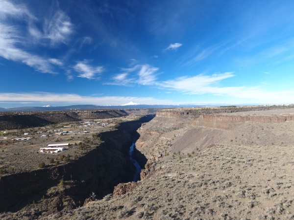
ROUGH TERRAIN
Our drones provide a safer, more cost effective way to collect data in rugged environments.

BUILDERS & CONTRACTORS
Track job progress, conduct job site surveys and create visual histories of your projects. Measure and manage aggregate, equipment and roads.
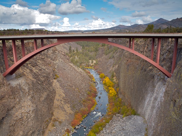
SAFETY INSPECTION
Drones provide safer, cost effective ways to inspect power lines, cell phone towers, bridges and other spanned structures while reducing traffic control issues.
ROUGH TERRAIN
Our drones provide a safer, more cost effective way to collect data in rugged environments.
BUILDERS & CONTRACTORS
Track job progress, conduct job site surveys and create visual histories of your projects. Measure and manage aggregate, equipment and roads.
SAFETY INSPECTION
Drones provide safer, faster and more convenient and less expensive ways to inspect power lines, cell phone towers, bridges and other spanned structures.
IMAGES CAPTURED
Acres Covered, Flights and Images Captured numbers posted above are current as of year end 2020
EMERGENCY RESPONSE
Our drone can fly into dangerous situations to map the accident, perform risk assessment and guide first responders to increase the possibility of survival and reduce the threat to rescuers.
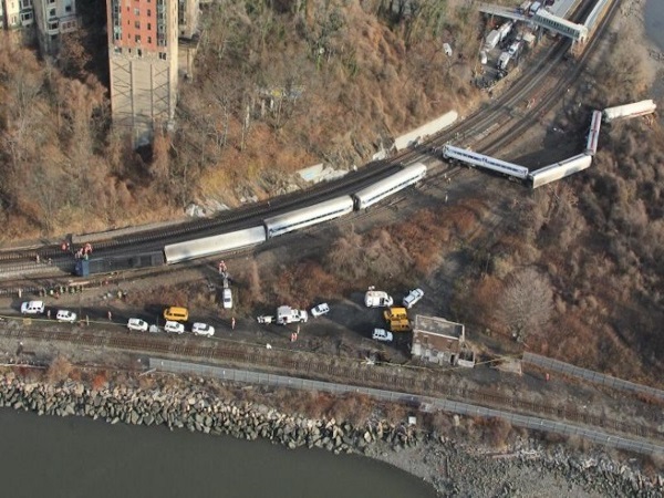
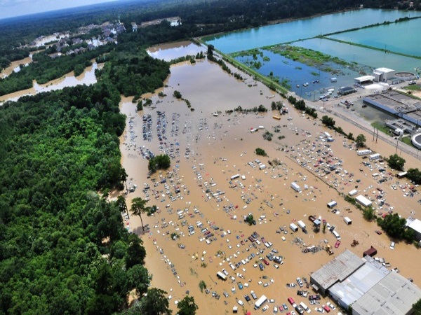
ACCIDENT INVESTIGATION
Accident investigations, damage assessments, liability determination, cause of action and point of origin from a drone perspective. Drones can create archived, measurable and geo-referenced data of accidents or crime scenes to streamline investigations.
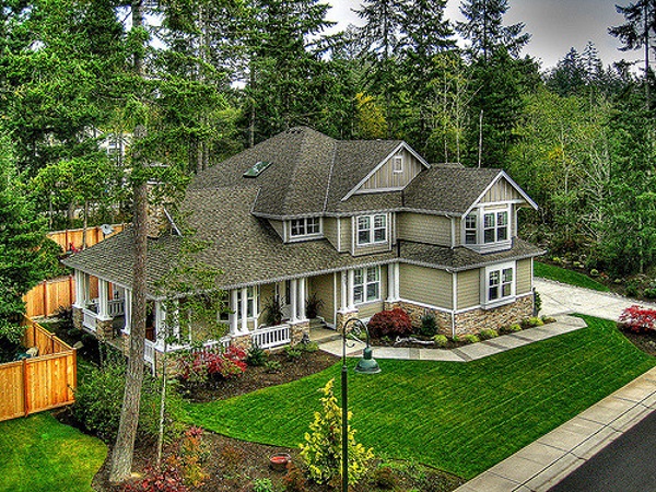
REAL ESTATE
Improve the sale-ability of residential and commercial real estate with a virtual tour from a 360 degree perspective of lots, land, ranches, farms and estates.
EMERGENCY RESPONDERS
Our drone can fly into dangerous situations to perform risk assessment and guide first responders to increase the possibility of survival and reduce the threat to rescuers.
ACCIDENT INVESTIGATION
Accident investigations, damage assessments, liability determination, cause of action and point of origin from a drone perspective. Drones can create archived, measurable and geo-referenced data of accidents or crime scenes to streamline investigations.
REAL ESTATE
Improve the sale-ability of residential and commercial real estate with a 360 degree, birdseye view of lots, land, ranches, farms and estates.
YEARS SURVEYING IN OREGON

INSURANCE CLAIMS
Using drones can streamline claims process by providing adjusters with an 360 degree aerial inspection to accurately assess the damage and begin claim reporting.
When I needed to show my real estate clients a new perspective on a beautiful mountain top home, Paul Povey at Povey Drone Services scheduled the flight quickly and produced a high quality video that I was able to share with my buyers which sold the home. Thank you Paul!
%
CLIENT SATISFACTION
6,897
ACRES COVERED
181
DRONE FLIGHTS
68,444
IMAGES CAPTURED
Acres Covered, Flights and Images Captured numbers posted above are current as of year end 2020
INSURANCE CLAIMS
Using drones can streamline claims process by providing adjusters with an 360 degree aerial inspection to accurately assess the damage and begin claim reporting.
99
YEARS SURVEYING IN OREGON
When I needed to show my real estate clients a new perspective on a beautiful mountain top home, Paul Povey at Povey Drone Services scheduled the flight quickly and produced a high quality video that I was able to share with my buyers which sold the home. Thank you Paul!
Susan T – Realtor
100%
CLIENT SATISFACTION
POVEY & ASSOCIATES DRONE SERVICES
PAUL POVEY
FAA LICENSED | BONDED | INSURED
(541) 480-2690
USA DOT FAA #3920299
OFFICE ADDRESS
338 SW 7TH STREET REDMOND OR 97756
MAILING ADDRESS
PO BOX 131 REDMOND OR 97756
Drone services are just a call or email away.
POVEY & ASSOCIATES
DRONE SERVICES
PAUL POVEY
FAA LICENSED
BONDED
INSURED
USA DOT FAA #3920299
OFFICE ADDRESS
338 SW 7TH STREET REDMOND OR 97756
MAILING ADDRESS
PO BOX 131 REDMOND OR 97756